Tourist Information Schwangau
- www.schwangau.de
- Aktivitäten
- Schwangau im Winter
- Ski, Langlauf, Winterwandern
3 Castles Trail
Wanderung
· Allgäu
geschlossen

Verantwortlich für diesen Inhalt
Tourist Information Schwangau Verifizierter Partner Explorers Choice
Tourist Information Schwangau Verifizierter Partner Explorers Choice
-
 SchwanseeFoto: Stephanie Müller, Tourist Information Schwangau
The "Pöllatschlucht" (a wild gorge) is currently closed.
Carpark Hohenschwangau - Pöllat Gorge - Marien Bridge - Village Hohenschwangau - Castle Hohenschwangau - Schwansee lake - Kalvarienberg - City Füssen - Village Horn - carpark Hohenschwangau
geschlossen
mittel
Strecke 14 km
4:30 h
426 hm
435 hm
984 hm
785 hm
Nice hike through the royal landscape with many views.

Autor
Tourist Information Schwangau
Aktualisierung: 07.06.2023
Schwierigkeit
mittel
Kondition
Erlebnis
Landschaft
Höchster Punkt
984 m
Tiefster Punkt
785 m
Beste Jahreszeit
Jan
Feb
Mär
Apr
Mai
Jun
Jul
Aug
Sep
Okt
Nov
Dez
Wegearten
Asphalt
8,7 km
Schotterweg
3,5 km
Pfad
1 km
Straße
0,7 km
Start
Koordinaten:
DD
47.557365, 10.739053
GMS
47°33'26.5"N 10°44'20.6"E
UTM
32T 630829 5268570
w3w
///entstandenen.fein.bedeckten
Wegbeschreibung
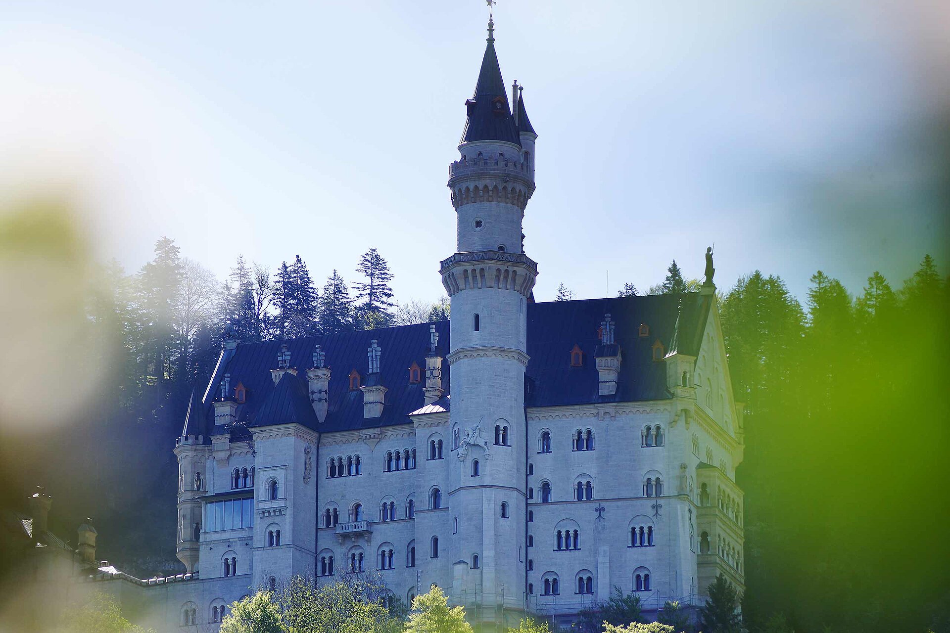
The hike begins from Hohenschwangau car park 3 with an adventurous ascent through "Pöllatschlucht" (a wild gorge). At the top, a detour to the "Marienbrücke" (Bridge) is well worthwhile with the magnificent view of Neuschwanstein Castle. After a short distance downhill to the valley is the Ticket Center, castle tour must be purchased in advance here. Continue a 10 min climb towards Hohenschwangau Castle, follow the signs to Schwansee. At Schwansee, follow the Kônigsstrasse in the direction of Füssen. After a few hairpin bends, you will reach Kalvarienberg which is essential to visit, because from here you will have a 360 degree panoramic view of the 3 Castles, Neuschwanstein, Hohenschwangau and Hohes Schloss, Füssen, the impressive mountain scenery and the Allgaüer Voralpenland with its numerous lakes. The descent is via the Way of the Cross to Füssen, where the beautiful medieval town and the Hohes Schloss (gallery) invites you to visit. After passing through the old town, keep right at the Kaiser-Maximilian-Platz and head out of town towards Lech/Schwangau-Horn. After about 10 mins, you will cross the Lech and walk back on the footpath to Hohenschwangau.
Öffentliche Verkehrsmittel
Busstop "Hohenschwangau - Castles"Anfahrt
You have to look to the signs "Hohenschwangau - Königsschlösser"Parken
Some carparks near the castlesKoordinaten
DD
47.557365, 10.739053
GMS
47°33'26.5"N 10°44'20.6"E
UTM
32T 630829 5268570
w3w
///entstandenen.fein.bedeckten
Anreise mit der Bahn, dem Auto, zu Fuß oder mit dem Rad
Status
geschlossen
Schwierigkeit
mittel
Strecke
14 km
Dauer
4:30 h
Aufstieg
426 hm
Abstieg
435 hm
Höchster Punkt
984 m
Tiefster Punkt
785 m
Statistik
Karten und Wege
- 13 Wegpunkte
- 13 Wegpunkte
Strecke
km
Dauer
: h
Aufstieg
hm
Abstieg
hm
Höchster Punkt
m
Tiefster Punkt
m