- www.schwangau.de
- Aktivitäten
- Schwangau im Winter
- Ski, Langlauf, Winterwandern
Hiking trail to Drehhütte and Rohrkopfhütte (mountain huts)

Tourist Information Schwangau Verifizierter Partner Explorers Choice
-
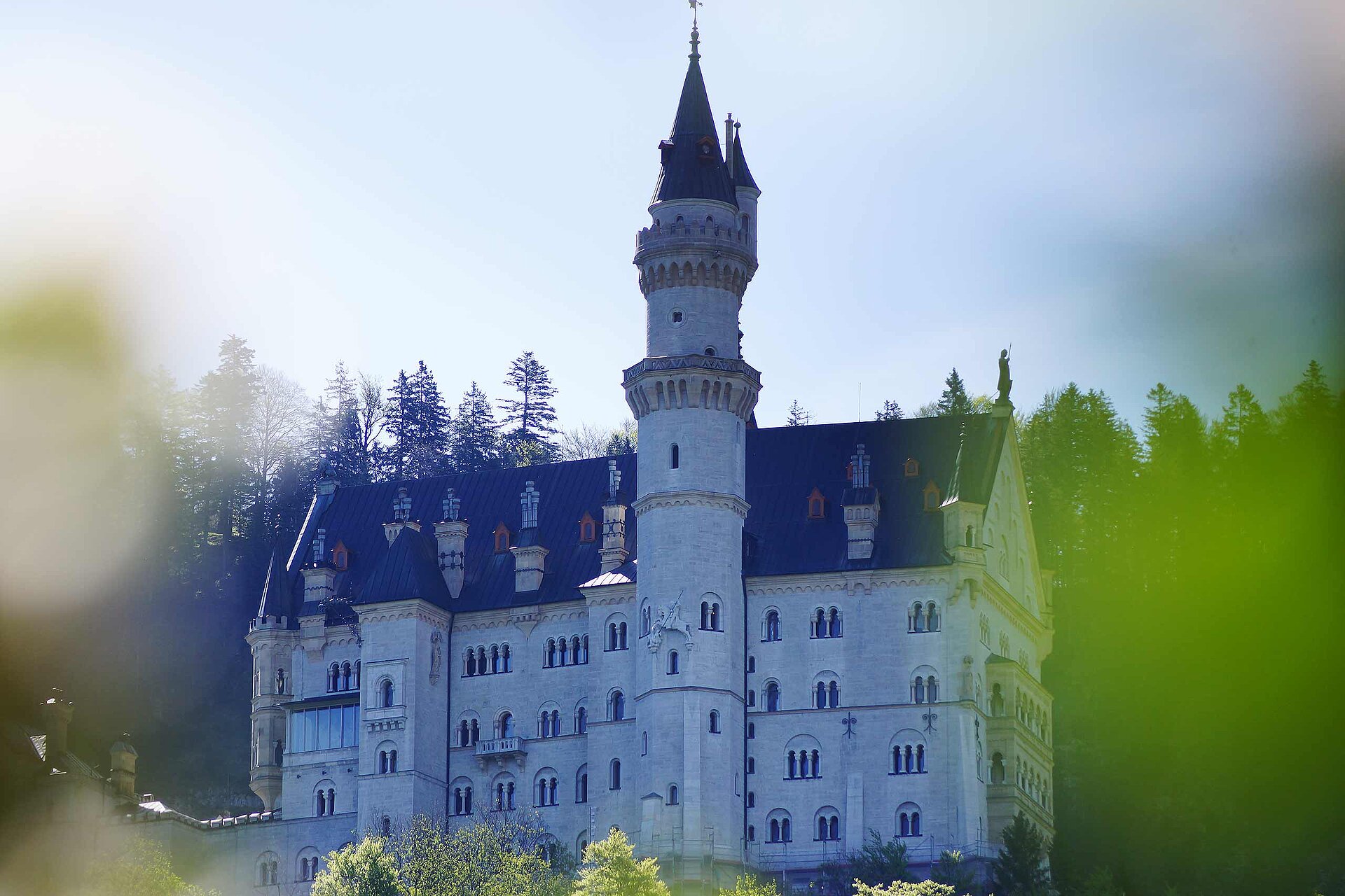
 Ausblick auf die KönigsschlösserFoto: Stephanie Müller, Tourist Information Schwangau
Carpark Tegelbergbahn – Schutzengelweg - Rohrkopfhütte – Drehhütte – Carpark Tegelbergbahn
Nice tour with wonderful views of Neuschwanstein Castle, Hohenschwangau Castle and the landscape. Refreshments in the mountain huts. For more follow this Link.

Wegearten
Einkehrmöglichkeiten
RohrkopfhütteDrehhütte
Weitere Infos und Links
Rohrkopfhütte https://www.hotelruebezahl.de/de/rohrkopfhuette-berghuette-allgaeu/
Drehhütte http://www.drehhuette.de/
Start
Ziel
Wegbeschreibung
From the Tegelberg valley station, where there is paid parking and a bus stop, hike through the forest along the Schutzengelweg trail to the Rohrkopf Hut. Please always follow the signs "Schutzengelweg". Enjoy the unique views of the royal castles and the mountain panorama. After about an hour you will reach the wonderful sun terrace of the Rohrkopfhütte, from where you can enjoy Allgäu specialities with a view of Neuschwanstein Castle and the Alp and Schwan lakes. The way back is via the Drehhütte, which you reach after about 20 minutes. Then hike down the road through the forest with beautiful views of the Forggensee and Bannwaldsee lakes. After about an hour, you will reach the Outward Bound car park. From here, follow a comfortable meadow path back to the starting point at the Tegelberg valley station.
Öffentliche Verkehrsmittel
You can use the busses to "Tegelbergbahn"Anfahrt
From Schwangau you have to look to the signs "Tegelbergbahn"Parken
Some carparks near the cablecar "Tegelbergahn"Koordinaten
Ausrüstung
sturdy footwear, drinks, weatherproof clothing
Statistiken
- 4 Wegpunkte
- 4 Wegpunkte
-
Tour
-
Neigung