Tourist Information Schwangau
- www.schwangau.de
- Aktivitäten
- Schwangau im Winter
- Ski, Langlauf, Winterwandern
Hike to Bleckenau (mountain hut)
Wanderung
· Allgäu

Verantwortlich für diesen Inhalt
Tourist Information Schwangau Verifizierter Partner Explorers Choice
Tourist Information Schwangau Verifizierter Partner Explorers Choice
-
 Foto: Stephanie Müller, Tourist Information Schwangau
Carpark Hohenschwangau - Bleckenau - Neuschwanstein - Carpark Hohenschwangau
mittel
Strecke 10,6 km
3:40 h
374 hm
389 hm
1.177 hm
804 hm
Nice tour to the former royal hunting lodge of King Ludwig II.

Autor
Tourist Information Schwangau
Aktualisierung: 30.08.2023
Schwierigkeit
mittel
Kondition
Erlebnis
Landschaft
Höchster Punkt
1.177 m
Tiefster Punkt
804 m
Beste Jahreszeit
Jan
Feb
Mär
Apr
Mai
Jun
Jul
Aug
Sep
Okt
Nov
Dez
Wegearten
Asphalt
6,2 km
Schotterweg
4,4 km
Straße
0 km
Einkehrmöglichkeiten
Berggasthaus BleckenauWeitere Infos und Links
Bleckenau: www.berggasthaus-bleckenau.de
Neuschwanstein: www.neuschwanstein.de or www.hohenschwangau.de
Restaurants: www.schwangau.de/tisch
Start
carpark hohenschwangau
Koordinaten:
DD
47.556918, 10.740916
GMS
47°33'24.9"N 10°44'27.3"E
UTM
32T 630970 5268524
w3w
///etwaiger.bestecke.stute
Ziel
carpark hohenschwangau
Wegbeschreibung
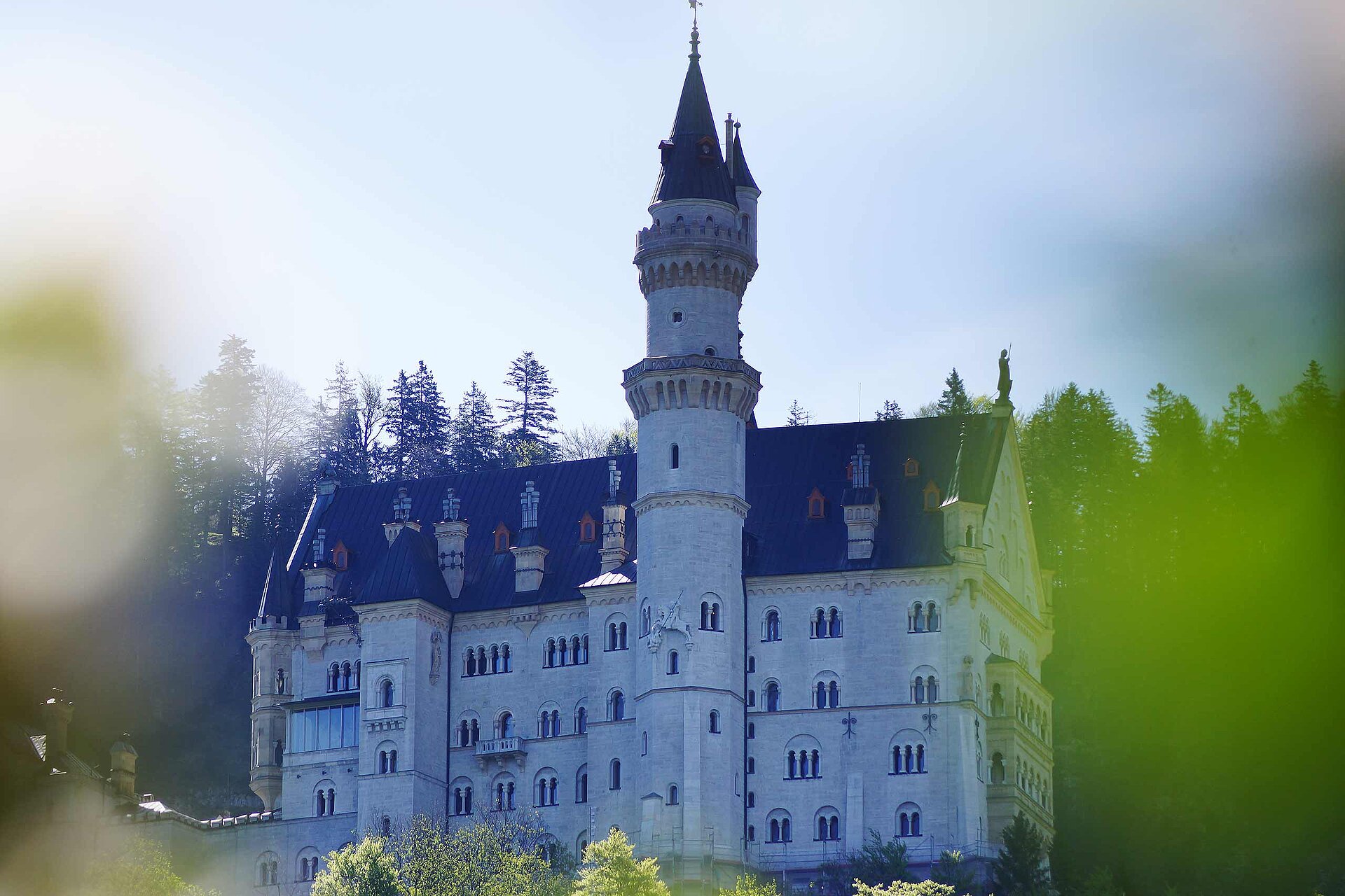
From Hohenschwangau, the path leads steeply uphill to the Jugend bus stop, where buses stop that take visitors to Neuschwanstein Castle. From the Brunnstubenweg gradually leads up to the high valley of Bleckenau. Once pass the Neuschwanstein Castle, it welcomes you serenity as you leave behind the bustle of everyday life. After the ascent through the mountain forest, the landscape widens and reveal an awesome impressive view of the rocky peaks, with mighty maple trees on the flat valley floor. Maximilian II had the 'Schweizerhaus' specially built around 1850 for his wife Marie, which King Ludwig II eventually used it as a hunting lodge - today's mountain inn Bleckenau. After a hearty snack, you may return on the Bleckenau road to the starting point or take the Bleckenau bus.
Öffentliche Verkehrsmittel
Busstop "Hohenschwangau Castle"Anfahrt
You have to look to the signs "Hohenschwangau - Königsschlösser"Parken
Some carparks near the castlesKoordinaten
DD
47.556918, 10.740916
GMS
47°33'24.9"N 10°44'27.3"E
UTM
32T 630970 5268524
w3w
///etwaiger.bestecke.stute
Anreise mit der Bahn, dem Auto, zu Fuß oder mit dem Rad
Schwierigkeit
mittel
Strecke
10,6 km
Dauer
3:40 h
Aufstieg
374 hm
Abstieg
389 hm
Höchster Punkt
1.177 m
Tiefster Punkt
804 m
Statistiken
Karten und Wege
- 4 Wegpunkte
- 4 Wegpunkte
-
Tour
-
Neigung
km
Strecke
: h
Dauer
hm
Aufstieg
hm
Abstieg
m
Höchster Punkt
m
Tiefster Punkt