Tourist Information Schwangau
- www.schwangau.de
- Aktivitäten
- Schwangau im Winter
- Ski, Langlauf, Winterwandern
Swan Lake Circular Trail
Wanderung
· Allgäu
geöffnet

Verantwortlich für diesen Inhalt
Tourist Information Schwangau Verifizierter Partner Explorers Choice
Tourist Information Schwangau Verifizierter Partner Explorers Choice
-
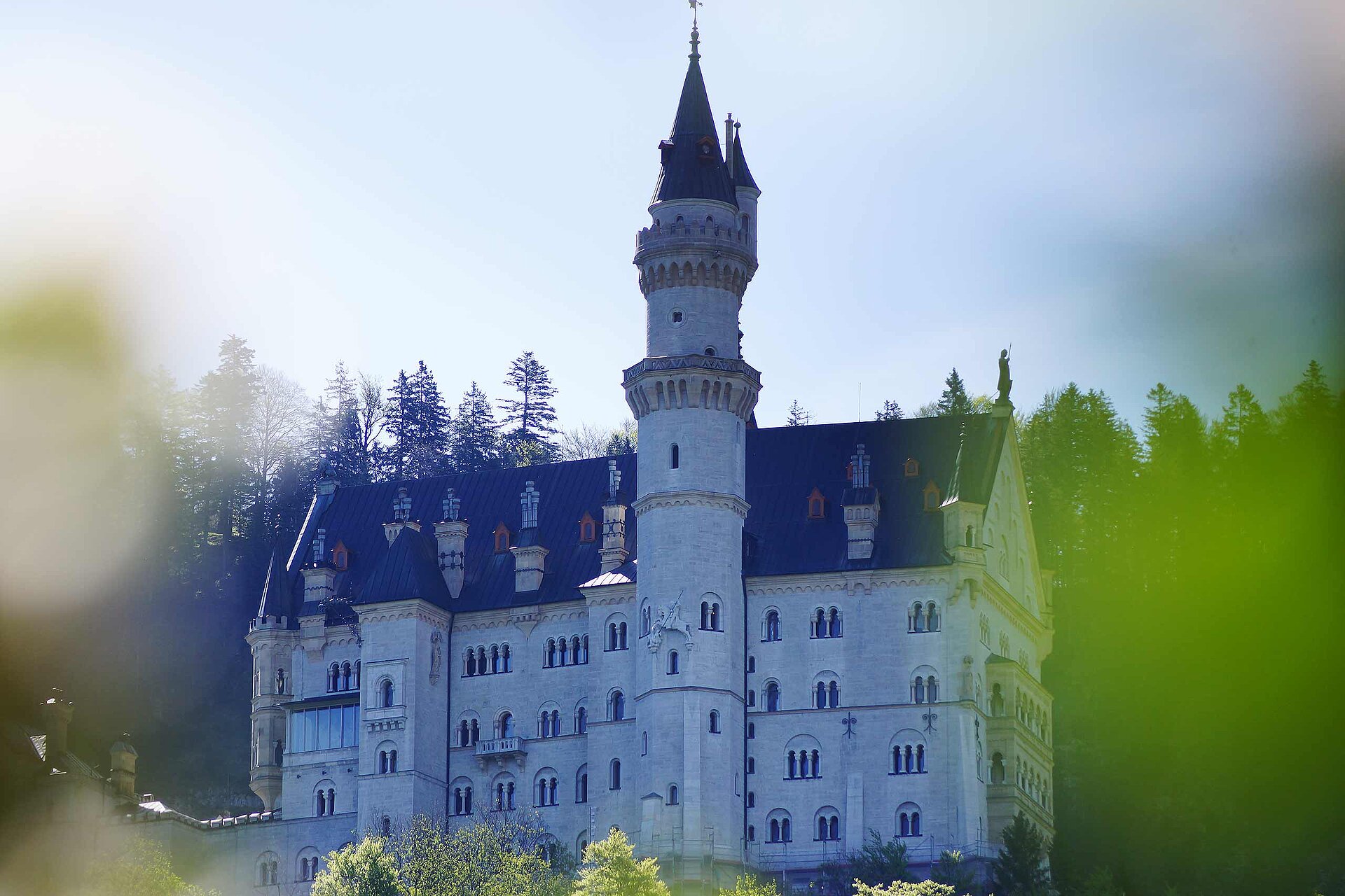
 Blick auf die KönigsschlöserFoto: Stephanie Müller, Tourist Information Schwangau
Small tour around the Swan Lake near the castles Neuschwanstein and Hohenschwangau.
geöffnet
leicht
Strecke 3,2 km
1:00 h
23 hm
23 hm
811 hm
788 hm
Nice walk in the Schwanseepark, the former royal park of the Wittelsbach family.

Autor
Tourist Information Schwangau
Aktualisierung: 07.06.2023
Schwierigkeit
leicht
Kondition
Erlebnis
Landschaft
Höchster Punkt
811 m
Tiefster Punkt
788 m
Beste Jahreszeit
Jan
Feb
Mär
Apr
Mai
Jun
Jul
Aug
Sep
Okt
Nov
Dez
Wegearten
Asphalt
3,1 km
Schotterweg
0,1 km
Naturweg
0,1 km
Start
Parkingplace Schwansee
Koordinaten:
DD
47.561717, 10.725862
GMS
47°33'42.2"N 10°43'33.1"E
UTM
32T 629826 5269032
w3w
///aufzugeben.abgesetzt.diener
Ziel
Parkingplace Schwansee
Wegbeschreibung
The landscape around Swan Lake at the foot of Hohenschwangau Castle welcomes you with surreality. Being declared a landscape conservation area, the uniqueness atmosphere in this historic park is still clearly noticeable today. From the car park in Alterschrofen, next to the road is a cleared footpath to the lake. Then you walk clockwise along the shore. From the beginning of the walk, you are already spoilt by the beauty of the view of both the castles Hohenschwangau and Neuschwanstein, plus the striking rocky mountains behind them served to you deliberately from the royal plate. Then the forest swallows you up as the north bank is shady. Furthermore, you can enjoy the sunlit moor meadows and the views of the reed covered bank at the end of the round.
Öffentliche Verkehrsmittel
Busstop "Alterschrofen"Anfahrt
You have to drive to the village "Schwangau-Alterschrofen" an there you have to turn right (or left) to the "Schwansee", here you have to look to the signsParken
carpark near the lakeKoordinaten
DD
47.561717, 10.725862
GMS
47°33'42.2"N 10°43'33.1"E
UTM
32T 629826 5269032
w3w
///aufzugeben.abgesetzt.diener
Anreise mit der Bahn, dem Auto, zu Fuß oder mit dem Rad
Status
geöffnet
Schwierigkeit
leicht
Strecke
3,2 km
Dauer
1:00 h
Aufstieg
23 hm
Abstieg
23 hm
Höchster Punkt
811 m
Tiefster Punkt
788 m
Statistiken
Karten und Wege
- 2 Wegpunkte
- 2 Wegpunkte
-
Tour
-
Neigung
km
Strecke
: h
Dauer
hm
Aufstieg
hm
Abstieg
m
Höchster Punkt
m
Tiefster Punkt