With the Schwangau hiking pass for large and small hiking enthusiasts, you now have the opportunity to explore our unique natural landscape on your own. As proof of your achievement, you will find a small wooden box with a punching tool on the respective routes.
Simply punch the corresponding hiking route in your hiking passport and show it at the tourist information after completing enough hiking tours. There you will receive a hiking pin as a reward and the little hikers a hiking certificate.
The printed Schwangau hiking pass is available free of charge at the Tourist Information Schwangau, at the information point in Hohenschwangau, at the Tegelbergbahn valley station and at the Ziegelwies Forest Adventure Center.
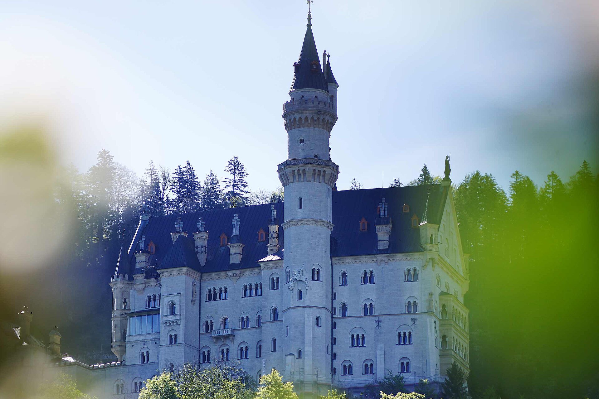
The hike starts from the Hohenschwangau parking lot. After a short distance you will see Neuschwanstein Castle (tickets for a tour must be purchased in advance in the valley at the ticket center or in the online ticket store). Continue on Schlossstraße into town and 10-minute climb to Hohenschwangau Castle. Then follow the signs to Schwansee. At Schwansee, continue on Königsstraße in the direction of Füssen. After a few hairpin bends, you come to the Kalvarienberg branch, which you should definitely climb, because from here a 360-degree panorama opens up on the three castles (Neuschwanstein, Hohenschwangau, Hohes Schloss, Füssen), the imposing mountain scenery and the Allgäu foothills of the Alps with its numerous lakes. The descent is via the Kreuzweg to Füssen, where the beautiful old town and the High Castle (gallery) invite you to visit. After crossing the old town, keep to the right at Kaiser-Maximilian-Platz out of town in the direction of Lech/Schwangau-Horn. After about 10 minutes you cross the Lech and walk on the footpath back to Hohenschwangau.
Öffentliche Verkehrsmittel
Nearest bus stop at the information point Hohenschwangau (Neuschwanstein-Hohenschwangau-Castles).
Anfahrt
Follow the signs Hohenschwangau/Königsschlösser
Parken
Paid parking in Hohenschwangau (P1-P4)
Koordinaten
DD
47.556885, 10.740908
GMS
47°33'24.8"N 10°44'27.3"E
UTM
32T 630970 5268520
w3w
///dunst.bereist.töpfe
Anreise mit der Bahn, dem Auto, zu Fuß oder mit dem Rad
Ähnliche Touren in der Umgebung
Drei-Schlösser-Weg
Hike to Bleckenau (mountain hut)
Besichtigung Schloss Neuschwanstein
Hüttentour - Bleckenau
Oberer Winterzugweg über dem Alpsee
Diese Vorschläge wurden automatisch erstellt.
Strecke
13,2 km
Dauer
4:15 h
Aufstieg
413 hm
Abstieg
413 hm
Höchster Punkt
982 m
Tiefster Punkt
785 m
Statistiken
Inhalte
Bilder einblendenBilder ausblenden
Funktionen
Karten und Wege
Tour
Neigung
Verschiebe die Pfeile, um den Ausschnitt zu ändern.

 Foto: Jana Lebetz, Tourist Information Schwangau